Photogrammetry

No matter how high-tech photographic equipment might be, there are cases in which a photograph is unable to fully capture the archaeological value and magnificence of an artifact. So, when a simple photograph is not enough, we take advantage of the impressive imaging capabilities that photogrammetry provides.

Photogrammetry is the science that extracts information regarding the volume and surface details of objects or areas by using photographic images. It can be used to create orthographic projection, contours, or even a completely photorealistic 3D model. When applied correctly and accurately, photogrammetry combines two essential advantages: the geometric precision of the 3D model and the photo-realism of the photographic image.

This method is suitable for facades of buildings, large and small objects (statues, ceramics), as well as any object with complex geometry such as a collapsing mosaic. It is also an excellent method of documentation when the viewing angle of a monument is limited, preventing us from viewing the entire monument from a single shooting angle.
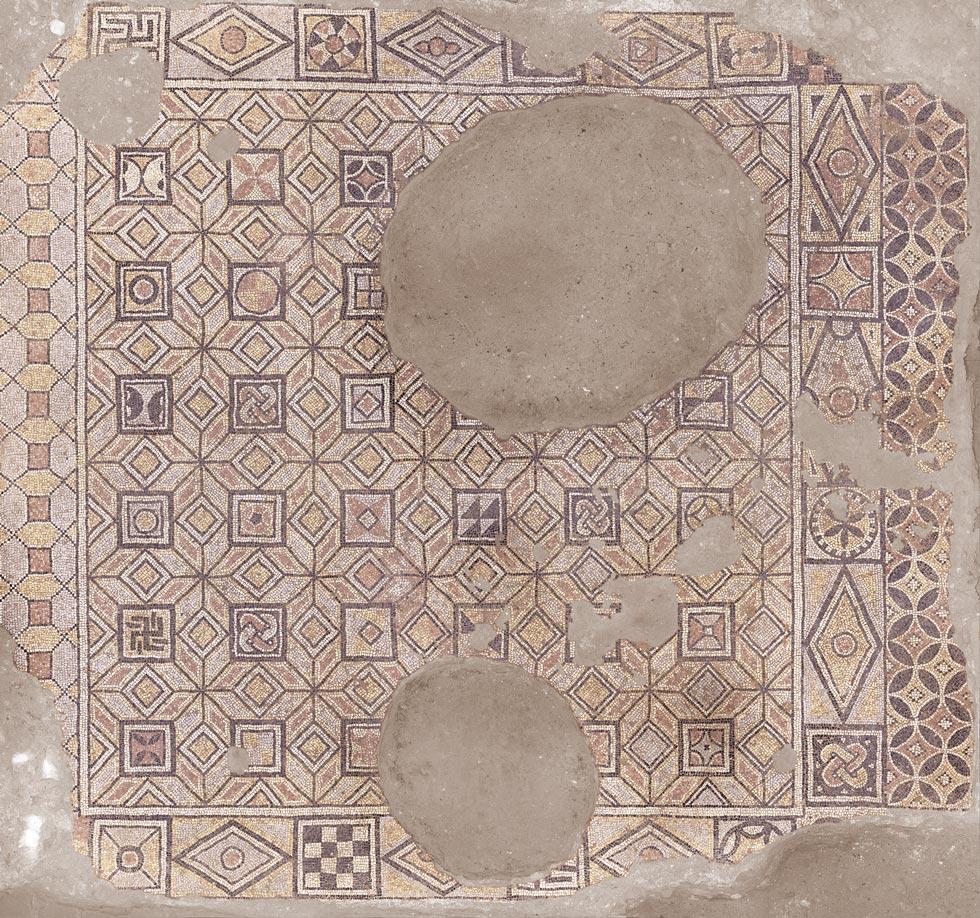
The mosaics of the excavation of the Thessaloniki Metro
The mosaics of the excavation of the Thessaloniki Metro at Agia Sophia Station provide a characteristic example. The available height above the mosaics is only 1.5m (5ft), making it impossible to photograph the whole mosaic vertically. The use of photogrammetry and the synthesis of hundreds of images made it possible to view the entire monument, while eliminating its distortion due to subsidence.
Aerial photogrammetry
Aerial photogrammetry refers to the method by which 3D Digital Terrain Models (DTMs) of a piece of land or a structure are produced as well as orthophoto maps using aerial imagery.

It is particularly suitable for fast and large-scale photorealistic mapping. On lower altitude flights, it can be used to capture buildings or smaller structures, such as mosaics or small burial grounds.
My specially designed octocopter drone equipped with a medium-format Hasselblad camera receives flight commands from a computer, ensuring unparalleled sharpness and precision in its movements - which is essential for a smooth and seamless stitching of multiple photos into a single image.